The best Route 66 attractions in Arizona sit along 385 miles of the Mother Road, between the red cliffs of Lupton and the Colorado River.
The state also holds the longest unbroken stretch of the old highway left anywhere. So there’s still a lot of real road to drive.
We live and work in Holbrook, one of the towns the road still runs through. That means we drive pieces of it every week.
Below, we’ve lined up the stops from east to west. For each one you’ll find the I-40 exit, what it costs in 2026 and what has closed or changed.
The highway turns 100 on November 11, 2026, so this is a good year to go.
Route 66 in Arizona at a Glance
Route 66 originally ran 385.2 miles across Arizona, according to the Historic Route 66 Association of Arizona. About 250 of those miles are still drivable.
The rest lies under Interstate 40 or has gone back to the desert. East of Flagstaff, that mostly means leaving I-40 at each town and following the business loop through it.
West of Ash Fork, though, the story changes. From Crookton Road at exit 139, the old highway runs about 158 miles to Topock without a break.
Because of that split, the attractions on Route 66 in Arizona fall into three stretches. First comes the high desert in the east, then the pine country around Flagstaff and finally the long western run.
One more thing before you go. Arizona stays on Mountain Standard Time all year, although the Navajo Nation does observe daylight saving time.
Driving straight across on I-40 takes about five hours. However, nobody comes to Route 66 to drive straight across.
The chart below sorts the main Route 66 attractions across Arizona by exit, with what each one costs.
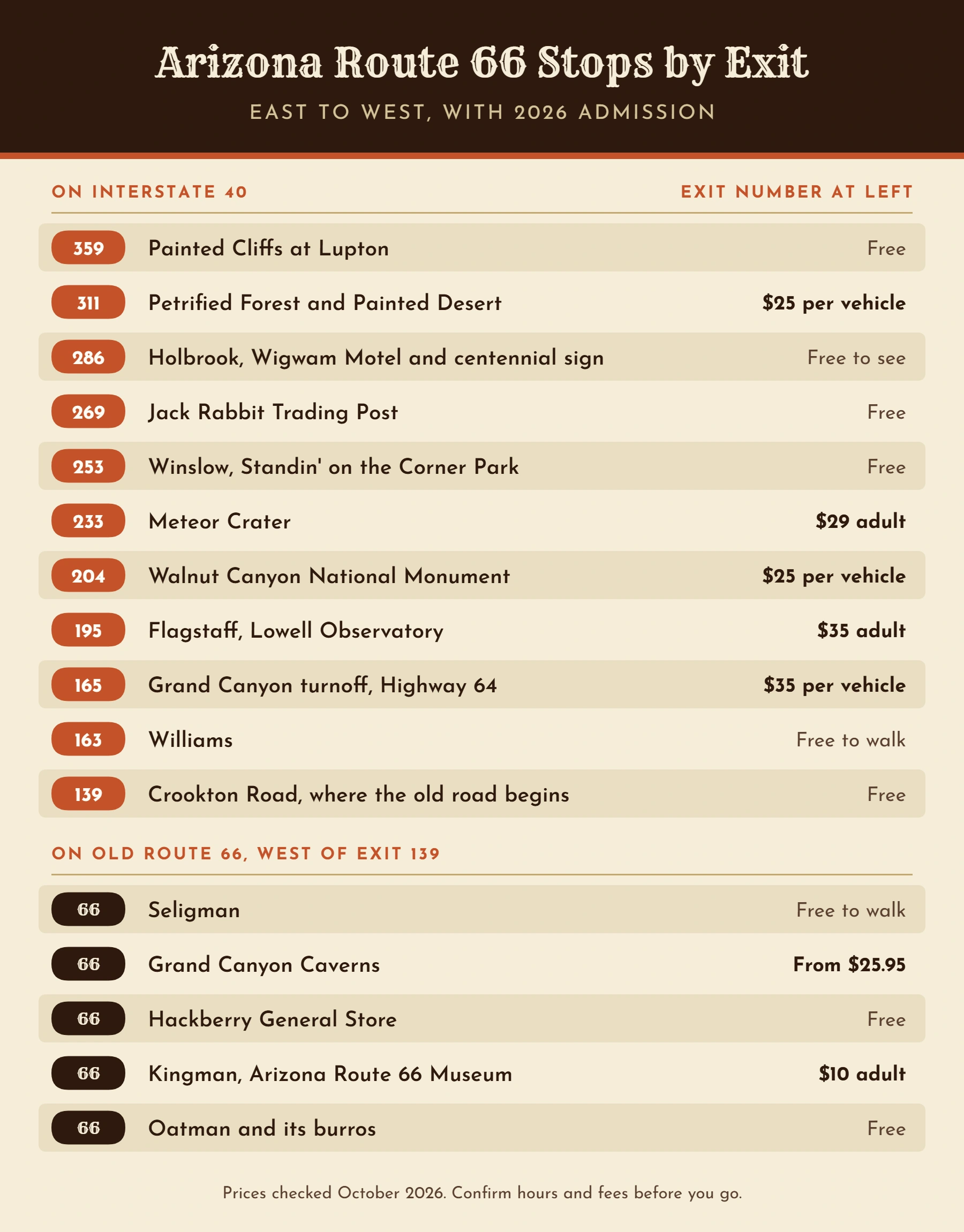
Route 66 Attractions in Eastern Arizona
Most of the old pavement is gone in this part of the state, so the stops are the story. Luckily, they’re good ones.
Where Route 66 Enters Arizona
Arizona opens with a wall of red sandstone. At exit 359, right on the New Mexico line, trading posts sit at the foot of the Painted Cliffs.
Statues of deer, bears and eagles stand on the ledges above them. Look for the 60-foot teepee of the Tee Pee Trading Post, too.
It’s a quick photo and souvenir stop, and there’s no ticket to buy.
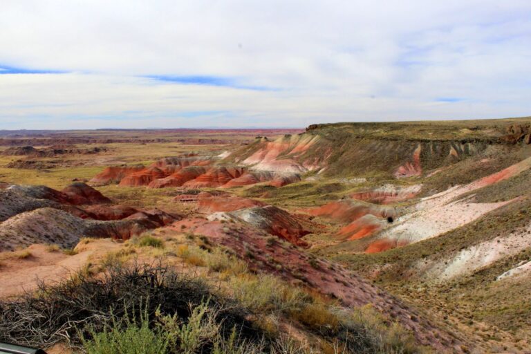
Petrified Forest and the Painted Desert
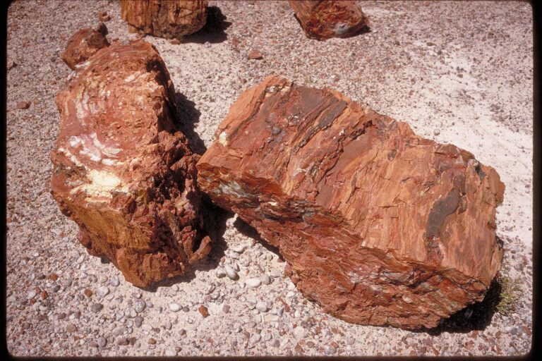
Petrified Forest is the only national park with a section of Historic Route 66 inside it, according to the National Park Service.
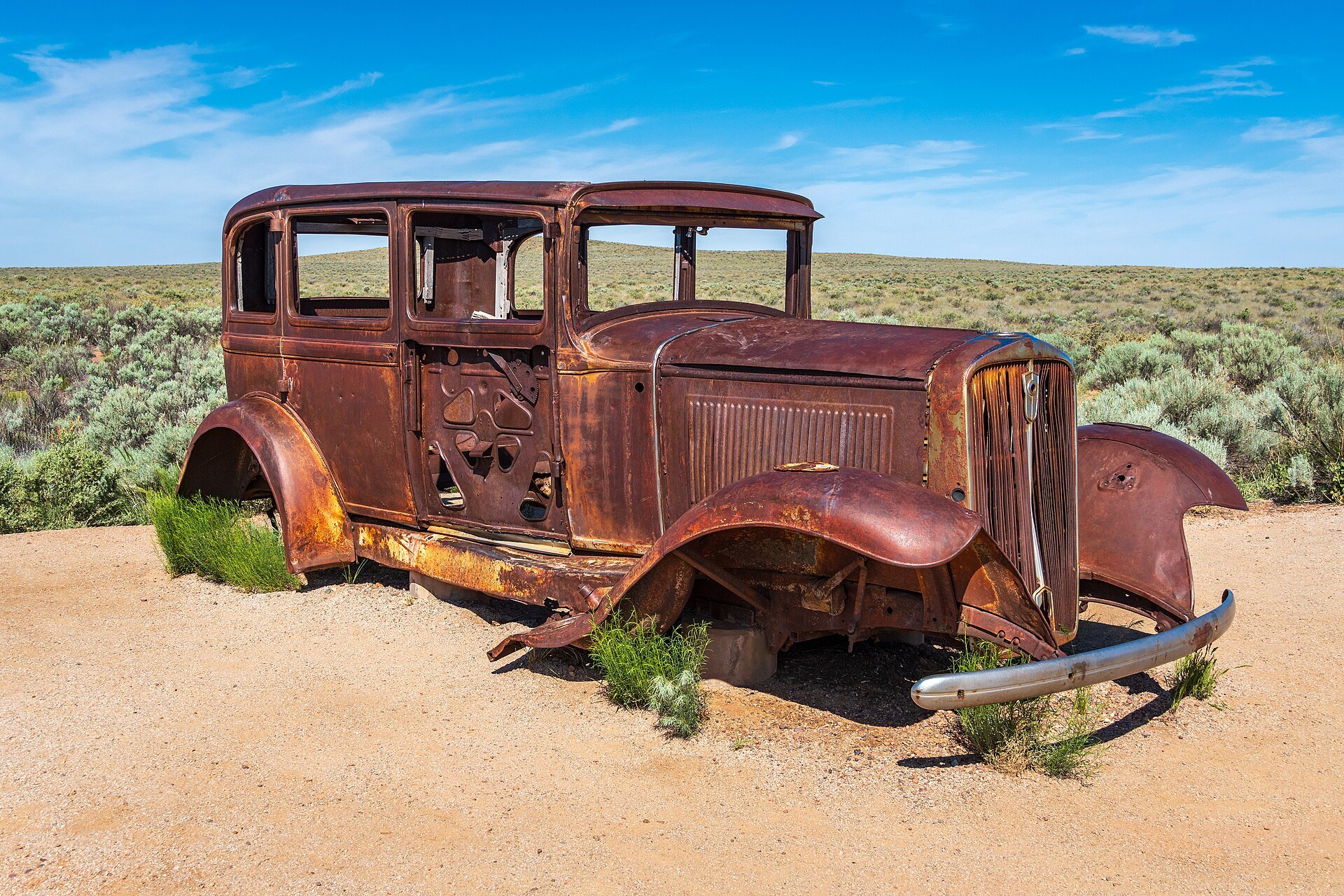
About six miles past the north entrance at exit 311, a rusted 1932 Studebaker marks the spot where the highway crossed the park. Behind it, a line of telephone poles still traces the old roadbed.
The Painted Desert Inn, two miles from the same entrance, deserves a stop as well. Inside, you’ll find murals that Hopi artist Fred Kabotie painted in 1948.
Entry costs $25 per vehicle and lasts seven days, but the park takes cards only. From there, the 28-mile park road runs south to US 180, which leads 19 miles into Holbrook.
For the full rundown, see our guide to things to do in Petrified Forest National Park.
Holbrook and the Wigwam Motel
This is our town, so forgive us if we linger.
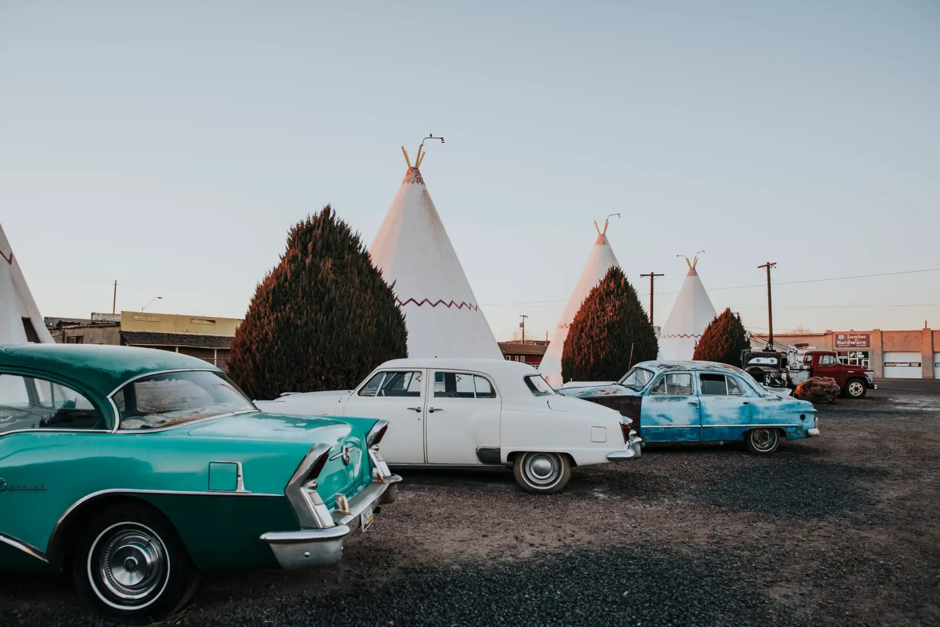
The Wigwam Motel is the stop most people already know. Chester E. Lewis opened it on June 1, 1950, and his family still runs its fifteen concrete teepees today.
Have you slept in a wigwam lately?
That’s the question on the motel’s sign, and you don’t need a reservation to enjoy the place. Anyone can pull in, wander the vintage cars out front and take photos for free.
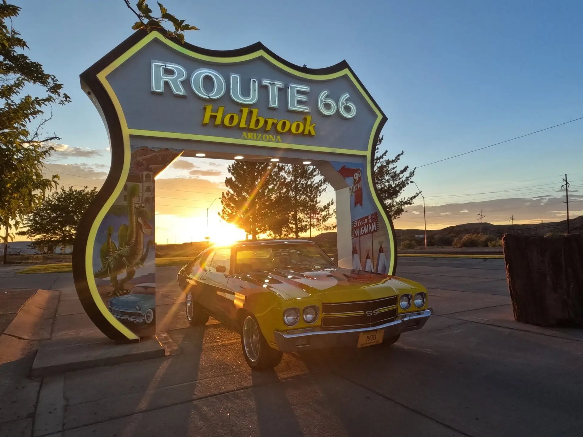
Holbrook also has one of the newest landmarks on the road. The drive-through Route 66 sign on Hopi Drive lit up for the first time on April 21, 2026. Local artist Richard Gorman painted it by hand, and the neon makes it worth a second visit after dark.
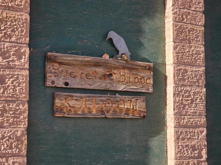
Downtown, the highway makes the last remaining 90 degree turn on all of Route 66. Just past the railroad tracks, you can also see the Bucket of Blood Saloon, an 1888 saloon that earned its name the hard way.
Before you leave, stop at Jim Gray’s Petrified Wood Co. for the free fossil museum in the back. Then, if you’re staying the night, compare our picks for the best places to stay in Holbrook.
Jack Rabbit Trading Post
About 17 miles west of Holbrook, at exit 269, stands one of the best-known signs on the route. It’s a yellow billboard with a black rabbit and three words, HERE IT IS.
James Taylor founded the Jack Rabbit Trading Post in 1949, and the Jaquez family has owned it since 1995.
A monsoon storm knocked down one side of the billboard in July 2026. However, it went back up within days, and the shop stayed open the whole time.
Winslow
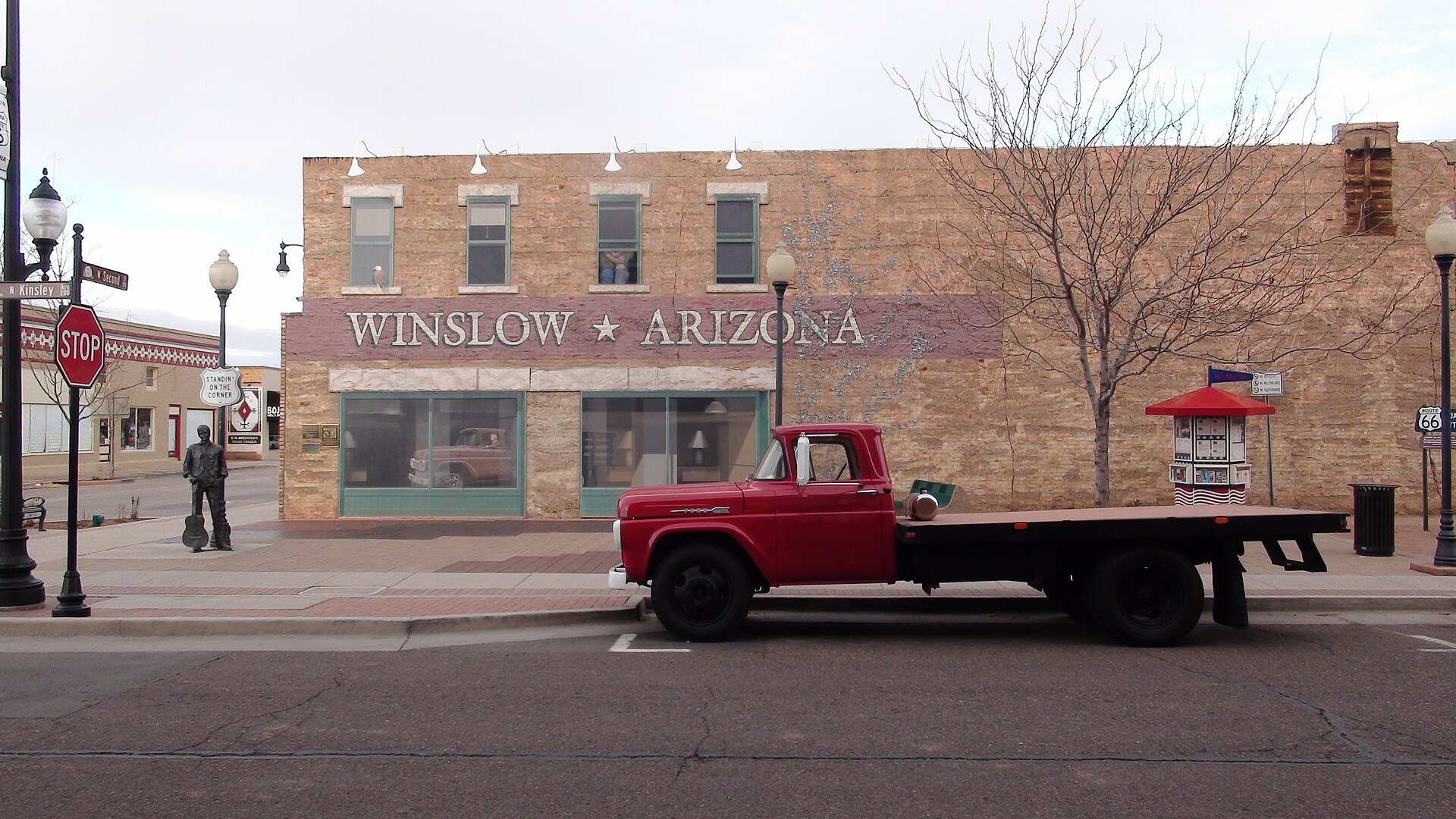
Winslow is the town from the song. Standin’ on the Corner Park sits at Kinsley Avenue and Second Street, which is old Route 66, and it’s free.
There, you’ll find a bronze troubadour with a guitar and a statue of Glenn Frey, which joined him in 2016. A flatbed Ford waits at the curb. Behind it, a two-story mural shows the girl from the Eagles’ Take It Easy reflected in a painted window.
Nearby is La Posada, which Mary Colter designed for the Fred Harvey Company. The hotel opened in 1930, closed in 1957 and came back after new owners bought it in 1997.
Today its Turquoise Room serves breakfast, lunch and dinner every day of the week.
Meteor Crater
Take exit 233, about 20 miles west of Winslow, and drive six miles south. There you’ll reach a hole in the ground roughly three-quarters of a mile wide and 550 feet deep.
A meteorite made it about 50,000 years ago. Much later, from 1964 through 1972, Apollo astronauts trained here.
The Barringer family still owns the crater, so a national parks pass won’t help. Adult admission is $29, and the site opens daily from 8 a.m. to 5 p.m.
Ruins and Revivals Before Flagstaff
Between Winslow and Flagstaff, three old roadside businesses show three different endings.
Meteor City, at exit 239, is the happy one. It sat closed from 2012 until new owners reopened it in May 2025, and it now has a dinosaur drive-through.
Two Guns, at exit 230, is a scatter of ruins on private land beside Canyon Diablo. Because nobody maintains the site, look from a distance and stay out of the buildings and the cave.
At Twin Arrows, exit 219, only one of the two giant arrows still stands. The other fell during high winds in February 2022.
Finally, if an older guide sends you to Fort Courage near Houck, skip it. Crews were tearing it down in February 2026.
Want to see this end of the state before you drive it? This video starts at the state line and rolls through Holbrook.
Flagstaff, Williams and the High Country
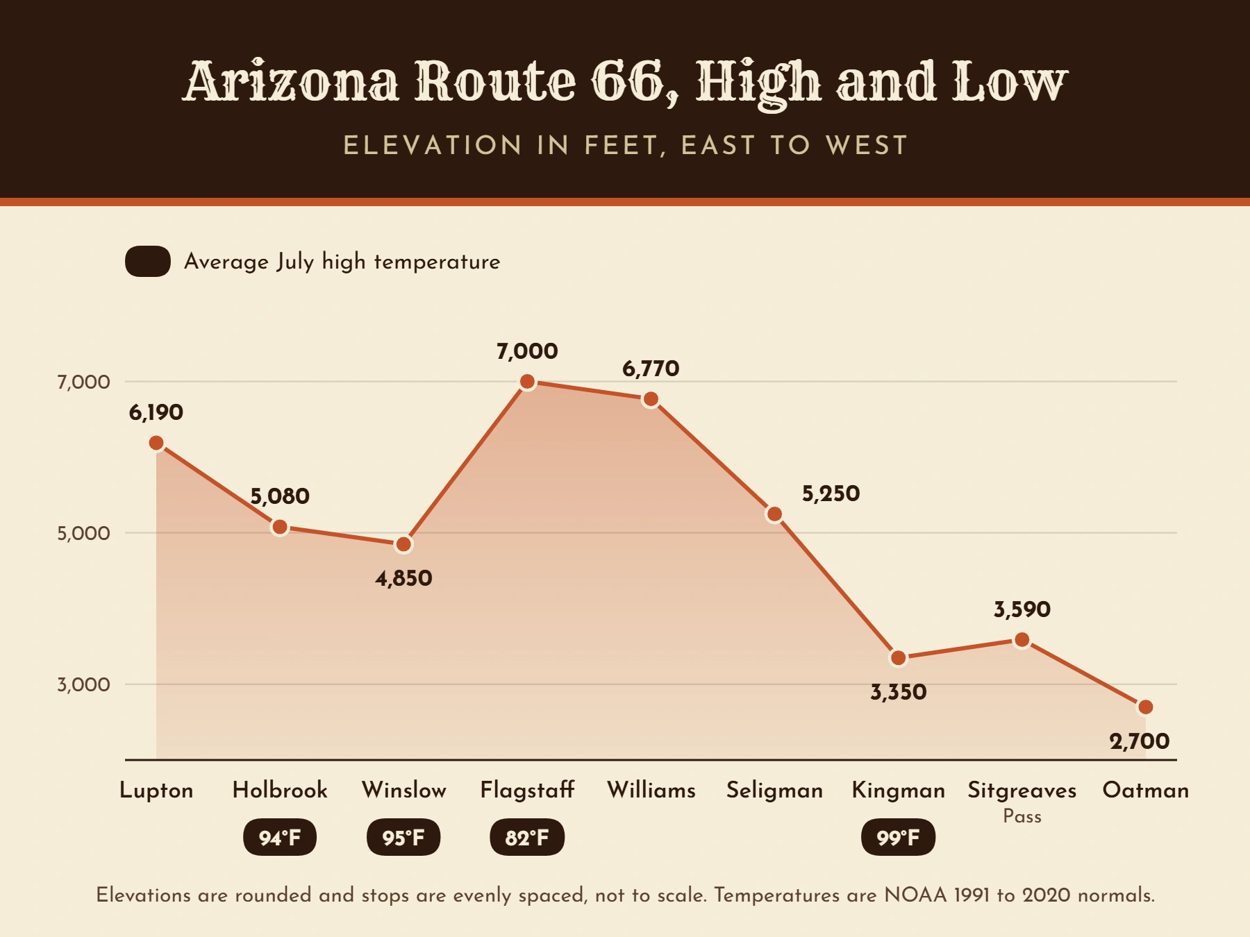
Past Twin Arrows, the desert gives way to pine forest and the road climbs to about 7,000 feet. It’s cooler up here, too. Flagstaff’s average July high is 82 degrees, which is 12 degrees below Holbrook’s.
Flagstaff
Before you reach town, Walnut Canyon National Monument sits three miles south of exit 204. Its Island Trail drops 240 stairs past 25 cliff dwelling rooms that are about 800 years old, and entry is $25 per vehicle.
In Flagstaff itself, start at the visitor center inside the 1926 Santa Fe depot at 1 East Route 66. From there, a self-guided audio tour called Walk This Talk follows the original alignment for about an hour.
Lowell Observatory is where Clyde Tombaugh discovered Pluto on February 18, 1930. Adult admission is $35, and the observatory closes on Tuesdays.
One change to know about is the Museum Club. The 1931 landmark closed after Halloween 2025 and was still for sale in spring 2026, so for now it’s a photo from the parking lot.
The Old Road Through the Pines
Between Flagstaff and Williams, the Kaibab National Forest has kept pieces of the earliest highway. Its auto tour covers 22 miles between Bellemont and Williams on paved and gravel roads.
Near Parks, for example, you can walk an abandoned stretch of pavement that carried Route 66 traffic from 1931 to 1941. The Old Route 66 Parks Store, which is more than a century old, still sells snacks and vintage candy.
The road tops out near Brannigan Park at about 7,300 feet, so expect snow on the ground in winter.
Williams
Williams holds a piece of Route 66 history that no other town can claim. On October 13, 1984, it became the last town on the entire route that the interstate bypassed.
Bobby Troup, who wrote the famous song about the highway, came to the ceremony.
Today the historic business district covers about six blocks along the old road. Pete’s Route 66 Gas Station Museum, inside a 1949 station, makes a quick stop that runs on donations.
Bearizona, a drive-through wildlife park at exit 165, charges adults $30 on weekdays and $35 on weekends.
Is the Grand Canyon Worth the Detour?
Yes, as long as you can give it a full day. The South Rim is about 60 miles north of Williams on Highway 64, and entry is $35 per vehicle.
International visitors should budget more. According to the park’s fee page, each non-U.S. resident aged 16 or older now pays an extra $100.
You can also leave the car behind. The Grand Canyon Railway departs Williams each morning, takes two hours and 15 minutes each way and returns the same evening.
The Longest Stretch of Old Route 66 in Arizona
Leave I-40 at Crookton Road, exit 139, and you won’t need the interstate again until the California line. Some of the best Route 66 attractions in Arizona are on these 158 miles.
If you only have time for one part of the state, make it this one.
Seligman
Seligman calls itself the Birthplace of Historic Route 66, and it has a fair claim. I-40 bypassed the town in 1978.
Then, in February 1987, barber Angel Delgadillo gathered people from towns along the road and started the Historic Route 66 Association of Arizona. That November, the state designated the road from Seligman to Kingman as Historic Route 66.
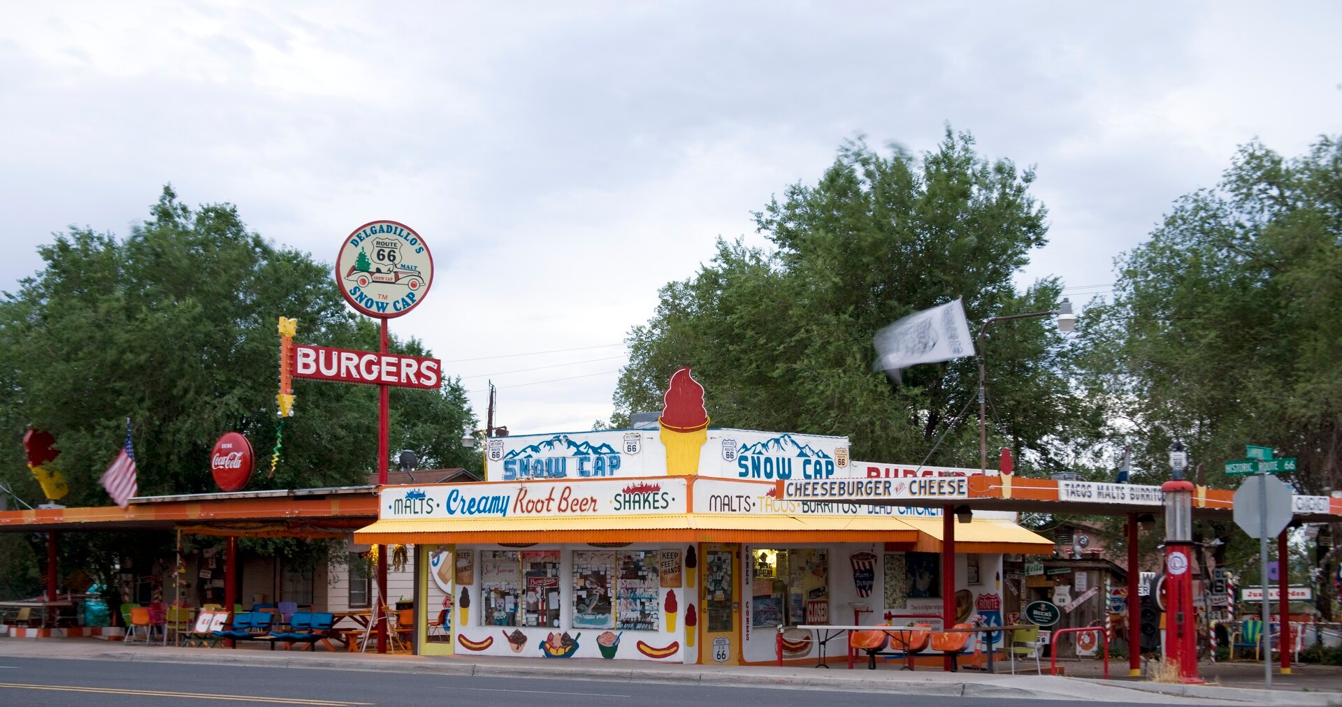
Angel turned 99 in April 2026. His old barbershop is now a gift shop, and nearby is Delgadillo’s Snow Cap, which Juan Delgadillo built in 1953 from scrap lumber.
The Snow Cap closes from Thanksgiving week until early spring, so plan around that.
You kill it, we grill it.
That’s the slogan at the Roadkill Cafe, another Seligman stop, where the menu includes bison and elk. West of town, watch for the Burma-Shave signs. They’re modern re-creations, since Arizona never had the originals.
Grand Canyon Caverns to Hackberry
Twenty-two miles west of Seligman, an elevator carries you about 200 feet down into Grand Canyon Caverns. Tours stopped after the elevator failed in October 2022, but they reopened in June 2025 with a new one.
Tours now start at $25.95. However, the famous underground hotel suite closed for good in March 2026.
Farther on is Peach Springs, the capital of the Hualapai Tribe. According to the National Park Service, the town helped inspire Radiator Springs in the movie Cars.
After that comes the Hackberry General Store, which opened in 1934 and now overflows with vintage gas pumps, old signs and classic cars. Then watch for Giganticus Headicus, a 14-foot tiki head that a local artist finished in 2004.
Kingman
Kingman is the largest town on this stretch, and the Powerhouse is the place to start. The old power plant houses the Arizona Route 66 Museum, where admission is $10 and kids 12 and under get in free with an adult.
Nearby, you can drive through a neon Route 66 shield. Locomotive Park, meanwhile, has a 1928 Santa Fe steam engine with a cab that visitors can climb into.
Clark Gable and Carole Lombard also married in Kingman on March 29, 1939, which matters once you reach Oatman.
Sitgreaves Pass and Cool Springs
From Kingman, the old road becomes a Back Country Byway that the Bureau of Land Management oversees.
Cool Springs Station, a rebuilt 1920s gas stop about 20 miles west of Kingman, sells cold drinks but no fuel. After that, the road climbs to Sitgreaves Pass at 3,586 feet through eight miles of curves and switchbacks.
This is no road for big rigs. The BLM says vehicles over 40 feet can’t cross the pass, and it recommends making the drive between October and April.
Skip it when rain is in the forecast, since the road crosses washes.
Oatman
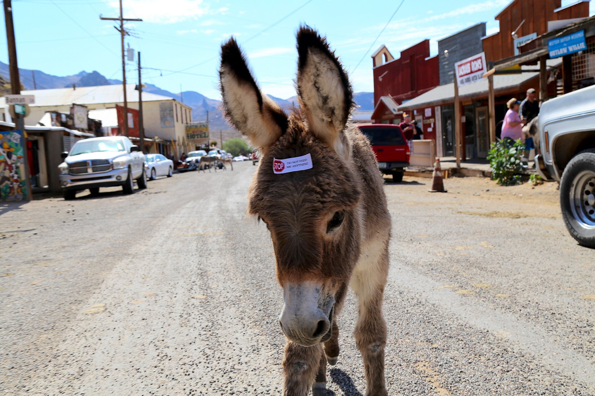
Oatman is an old gold mining town where wild burros wander the main street. They descend from animals that miners brought here beginning in the 1860s.
You can feed them the hay cubes sold in town, but never while they stand in the roadway. Leave the babies alone as well, because they wear a “do not feed” sticker for a reason.
Staged gunfights break out around noon most days. Meanwhile, inside the Oatman Hotel, dollar bills cover the saloon walls.
Local legend says Gable and Lombard spent their honeymoon upstairs. Not everyone agrees, though, and some accounts have the couple driving straight back to Los Angeles.
From Oatman, it’s about 25 miles down to Topock. There, the steel arch of the Old Trails Bridge, which carried cars from 1916 to 1948, still spans the Colorado River.
Planning Your Arizona Route 66 Drive
How Many Days Does Route 66 in Arizona Take?
Plan on at least three days. That’s the minimum the Historic Route 66 Association of Arizona suggests, and it puts the nonstop drive at about seven hours.
Arizona has more Route 66 attractions than a weekend can hold, so treat three days as a floor. We’d spend the first day between the state line and Holbrook, the second reaching Williams and the third on the western stretch.
Add a fourth day if you want the Grand Canyon.
Holbrook works well for that first night because it’s the closest town to the south entrance of Petrified Forest. You can stay in the park until closing and still make dinner in town.
When Is the Best Time to Go?
Spring and fall are the sweet spot, and elevation is the reason.
The road sits near 5,000 feet at Holbrook, climbs to 7,000 at Flagstaff and then drops below 3,000 at Oatman. As a result, the weather changes more than most visitors expect.
Flagstaff averages 90 inches of snow a year, and its average January low is about 18 degrees. Kingman’s average July high, on the other hand, is close to 99.
What Route 66 Attractions in Arizona Cost in 2026
Most of the stops on this list are free. For example, you won’t pay to see the Wigwam’s cars, Holbrook’s neon sign, Winslow’s corner, Seligman’s storefronts or Oatman’s burros.
The paid stops add up, though. Two adults who visit Petrified Forest, Meteor Crater and the Kingman museum will spend $103 on admission.
The three National Park Service stops are Petrified Forest, Walnut Canyon and the Grand Canyon. Together they run $85 per vehicle, so check whether an annual parks pass saves you money.
What’s Left of the Centennial Year
Route 66 became a U.S. highway on November 11, 1926, which makes 2026 its hundredth year.
Many of Arizona’s big celebrations have already happened, but a few remain. Kingman holds its Route 66 Fest on October 16 and 17, and Winslow lights a Route 66 themed Christmas tree on November 11, the anniversary itself.
The Arizona Department of Transportation keeps a list of ways to join the celebration.
Which Route 66 Attractions in Arizona Are Worth It?
Short on time? Here’s how we’d choose.
The most famous single spot is probably the corner in Winslow, because of the song. For a night you’ll talk about for years, though, sleep in a teepee at the Wigwam.
The best towns to explore on foot are Holbrook, Winslow, Williams, Seligman and Oatman. In Holbrook, our self-guided walking tour maps 50 stops downtown.
For the best stretch of real road, drive Seligman to Topock.
As for where to start, we’d begin at the New Mexico line and drive west, the same direction the song runs. That way, Petrified Forest and Holbrook come first and the best old pavement comes last.
Starting in the east? Tell us your dates and what you like, and our free trip planner will build your Holbrook stop for you.